Mannar City
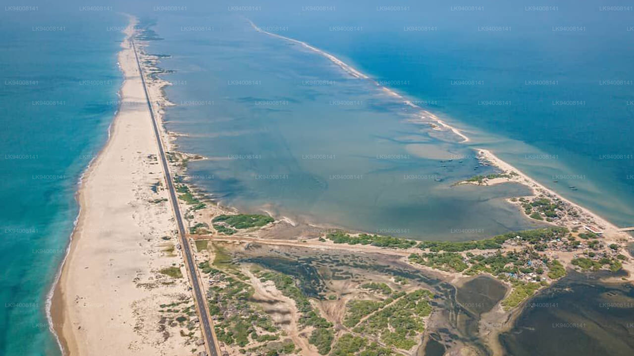
Mannar is the main town of Mannar District, Northern Province, Sri Lanka. It is governed by an Urban Council. The town is located on Mannar Island overlooking the Gulf of Mannar and is home to the historic Ketheeswaram temple.
Adams Bridge Ram Sethu
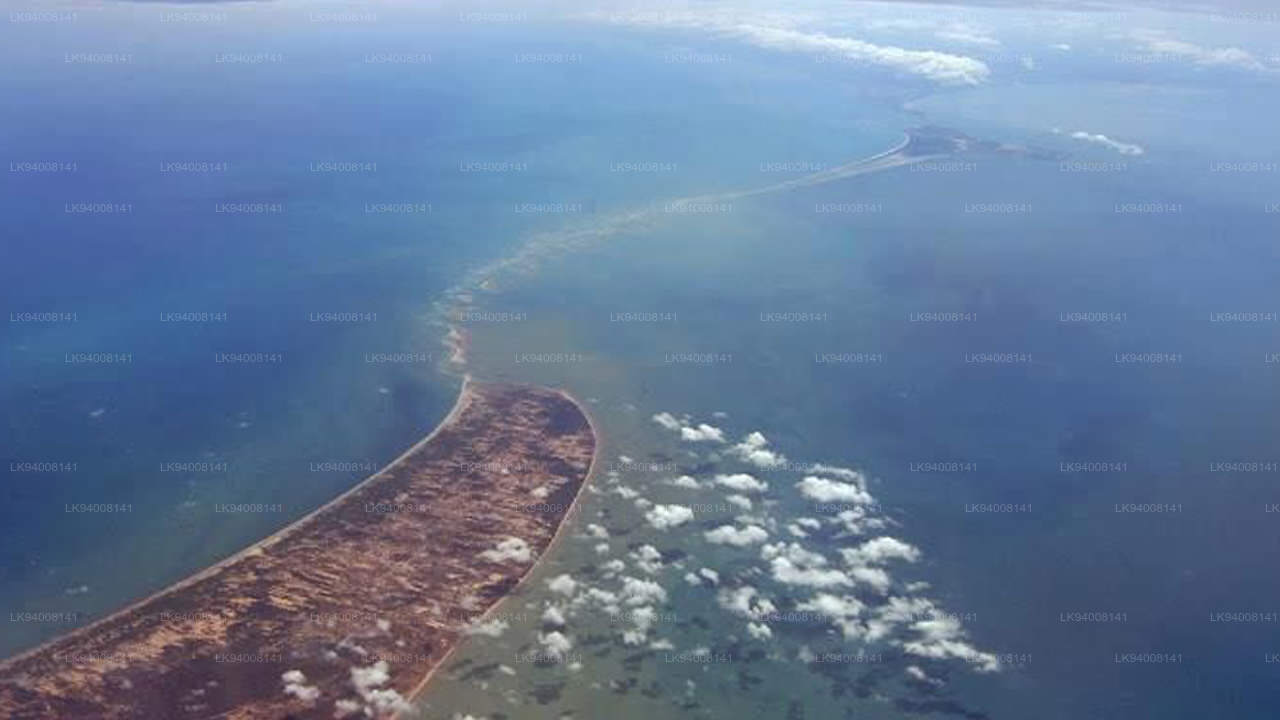
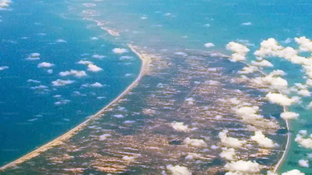
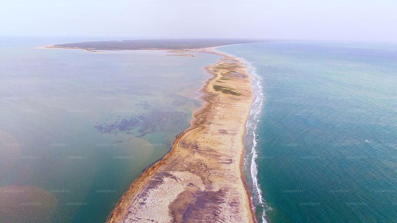
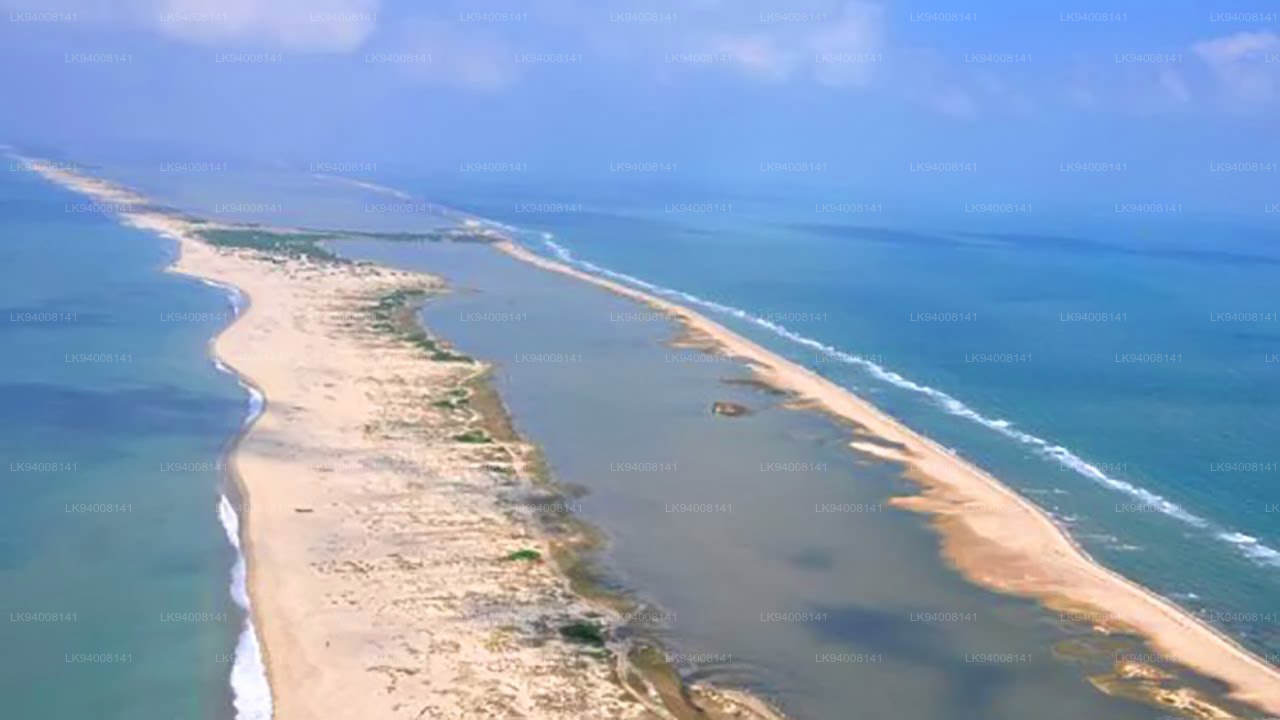
Adam's Bridge, also known as Rama's Bridge or Rama Setu, is a chain of natural limestone shoals, between Pamban Island, also known as Rameswaram Island, off the south-eastern coast of Tamil Nadu, India, and Mannar Island, off the north-western coast of Sri Lanka. Geological evidence suggests that this bridge is a former land connection between India and Sri Lanka.
The feature is 48 km (30 mi) long and separates the Gulf of Mannar (southwest) from the Palk Strait (northeast). Some of the regions are dry, and the sea in the area rarely exceeds 1 metre (3 ft) in depth, thus hindering navigation. It was reportedly passable on foot until the 15th century when storms deepened the channel. Ramanathaswamy Temple records say that Adam's Bridge was entirely above sea level until it broke in a cyclone in 1480.
Historical mentions and etymologyThe ancient Indian Sanskrit epic Ramayana (7th century BCE to 3rd century CE) written by Valmiki mentions a bridge constructed by god Rama through his Vanara (ape-men) army to reach Lanka and rescue his wife Sita from the Rakshasa king, Ravana. The location of the Lanka of the Ramayana has been widely interpreted as being present-day Sri Lanka making this stretch of land Nala's or Rama's bridge. Analysis of several of the older Ramayana versions by scholars for evidence of historicity have led to the identification of Lankapura no further south than the Godavari River. These are based on geographical, botanical, and folkloristic evidences as no archaeological evidence has been found. Scholars differ on the possible geography of the Ramayana but several suggestions since the work of H.D. Sankalia locate the Lanka of the epic somewhere in the eastern part of present-day Madhya Pradesh.
The western world first encountered it in Ibn Khordadbeh's Book of Roads and Kingdoms (c. 850), in which he refers to it as Set Bandhai or Bridge of the Sea. Some early Islamic sources refer to a mountain in Sri Lanka as Adam's Peak (where the biblical Adam supposedly fell to earth). The sources describe Adam as crossing from Sri Lanka to India via the bridge after his expulsion from the Garden of Eden, leading to the name of Adam's Bridge. Alberuni (c. 1030) was probably the first to describe it in such a manner. A British cartographer in 1804 prepared the earliest map that calls this area by the name Adam's bridge.
LocationThe bridge starts as a chain of shoals from the Dhanushkodi tip of India's Pamban Island. It ends at Sri Lanka's Mannar Island. Pamban Island is accessed from the Indian mainland by the 2-km-long Pamban Bridge. Mannar Island is connected to mainland Sri Lanka by a causeway.
Origin legendsIndian culture and religion include legends that the structure is of supernatural origin. According to the Hindu epic, Ramayana, Ravana, the demon king of Lanka (Sri Lanka) kidnapped Rama's wife Sita and took her to Lankapura, doing this for revenge against Rama and his brother Lakshmana for having cut off the nose of Ravana's sister, Shurpanakha. Shurpanakha had threatened to kill and eat Sita if Rama did not agree to leave her and marry Shurpanakha instead. To rescue Sita, Rama needed to cross to Lanka. Brahma created an army of vanaras (intelligent warrior monkeys) to aid Rama. Led by Nila and under the engineering direction of Nala, the vanaras constructed a bridge to Lanka in five days. The bridge is also called Nala Setu, the bridge of Nala. Rama crossed the sea on this bridge and pursued Ravana for many days. He fired hundreds of golden arrows which became serpents that cut off Ravana's heads, but ultimately had to use the divine arrow of Brahma (which had the power of the gods in it and cannot miss its target) to slay Ravana.
None of the early Ramayana versions provide geographical identifications that directly suggest that Lankapura was Sri Lanka. Versions of the Ramayana reached Sri Lanka in the sixth century but identifications of Sri Lanka with the land of Ravana are first noted in an 8th-century inscription from southern India. The idea that Sri Lanka was the Lankapura of the Ramayana is thought to have been promoted in the tenth century by Chola rulers seeking to invade the island and the identification of Sri Lanka as Ravana's land was supported by rulers of the Aryacakravarti dynasty who considered themselves guardians of the bridge. The idea of Rama Setu as a sacred symbol to be appropriated for political purposes strengthened in the aftermath of protests against the Sethusamudram Shipping Canal Project.
About Mannar District
Mannar is the capital of Mannar District, Sri Lanka. Mannar District is located in northwestern Sri Lanka. It is one of five administrative districts of the Northern Province. The district covers 2,002 sq. km, approximately 3% of the total land area of Sri Lanka. Geographically the bulk of Mannar is on the mainland within the arid and dry zone. High temperatures and low rainfall characterize the climate. The monthly temperatures range between 26.5°C and 30.0°C with highs normally recorded between May and August. Mannar receives nearly 60% of its rainfall during the northeast monsoon, which lasts from October through December. The land area is relatively flat and sits at low elevations. Towards the interior the terrain is gently undulating, favoring the storage of rainwater in tanks that provide the majority of the irrigation for the district's arable land. The primary economic activities in Mannar are crop cultivation (mainly paddy), fisheries and animal husbandry. Employment opportunities in the district are highly seasonal, and there are no institutional facilities for tertiary education.
About Northern Province
The Northern Province is one of the 9 provinces of Sri Lanka. The provinces have existed since the 19th century but they didn't have any legal status until 1987 when the 13th Amendment to the 1978 Constitution of Sri Lanka established provincial councils. Between 1988 and 2006 the province was temporarily merged with the Eastern Province to form the North-East Province. The capital of the province is Jaffna.
Northern Province is located in the north of Sri Lanka and is just 22 miles (35 km) from India. The province is surrounded by the Gulf of Mannar and Palk Bay to the west, Palk Strait to the north, the Bay of Bengal to the east, and the Eastern, North Central and North Western provinces to the south. The province has a number of lagoons, the largest being Jaffna Lagoon, Nanthi Kadal, Chundikkulam Lagoon, Vadamarachchi Lagoon, Uppu Aru Lagoon, Kokkilai lagoon, Nai Aru Lagoon, and Chalai Lagoon.Most of the islands around Sri Lanka are to be found to the west of the Northern Province. The largest islands are Kayts, Neduntivu, Karaitivu, Pungudutivu, and Mandativu.
The Northern Province's population was 1,311,776 in 2007. The majority of the populations are Sri Lankan Tamils, with a minority Sri Lankan Moor and Sinhalese population. Sri Lankan Tamil is the major language spoken in the province by the vast majority of the population. The other language spoken is Sinhala by 1 percent of the population. English is widely spoken and understood in the cities.
【Text by Lakpura™. Images by Google, copyright(s) reserved by original authors.】

